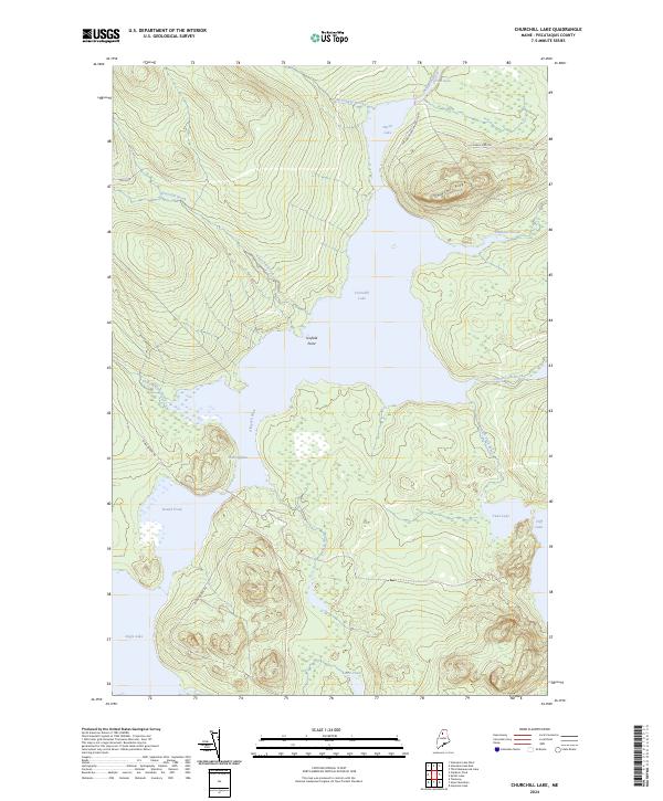
2024 Map of Churchill Lake
USGS Topo · Published 2024About this map
Allagash Wild and Scenic River protects the heart of the Maine North Woods in this remote section of Piscataquis County. The landscape is defined by the interconnected waters of Churchill Lake, Eagle Lake, and Heron Lake, which are linked by the Thoroughfare and Thoroughfare Brook. This hydrographic network historically served as a vital corridor for timber drives and wilderness travel. Grounded in the logging history of the region, access points like Johns Bridge Rd and Church Dam Rd provide terrestrial links to the water's edge. Notable terrain features such as Scofield Point and the high ground of Churchill Ridge overlook the basin, while the Allagash River flows northward toward Chase Rapids, marking the beginning of a more turbulent stretch of water.
Find a feature on this map
24 named features on this map. Tap any name to fly to it.
Don’t see what you’re looking for? This feature index may not catch every label — zoom into the map to look around manually.
Map Details
Editions of this 2024 Churchill Lake Map
This is the sole edition of this map. No revisions or reprints were ever made.
Other maps of this area

1932 · Umsaskis Lake
USGS Topo · 1:48,000

1932 · Musquacook Lakes
USGS Topo · 1:48,000

1935 · Umsaskis Lake
USGS Topo · 1:62,500

1935 · Musquacook Lakes
USGS Topo · 1:62,500

1954 · Spider Lake
USGS Topo · 1:62,500

1954 · Churchill Lake
USGS Topo · 1:62,500

1954 · Presque Isle
USGS Topo · 1:250,000

1958 · Presque Isle
USGS Topo · 1:250,000

1960 · Presque Isle
USGS Topo · 1:250,000

1961 · Spider Lake
USGS Topo · 1:62,500