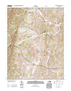
2013 Map of Churchville
USGS Topo · Published 2013About this map
Middle River winds through the heart of this Augusta County landscape, anchoring a network of historic settlements and agricultural corridors. The village of Churchville sits at a prominent crossroads to the north, while the landscape to the south is defined by the convergence of Back Creek and the river near Swoope. The topography transitions from the rising elevations of McKittricks Ridge in the northwest toward the more level valley floors where rural communities like Hebron and Christian took root. Genealogists and local historians can trace the paths of long-established family names through road labels such as Hangers Mill Road and Hundley Distillery Road. The map also captures the placement of several localized water features, including Smithleigh Lake and Castle Spring, which historically supported the region's homesteads and early industries.
Find a feature on this map
120 named features on this map. Tap any name to fly to it.
Don’t see what you’re looking for? This feature index may not catch every label — zoom into the map to look around manually.
Map Details
Editions of this 2013 Churchville Map
This is the sole edition of this map. No revisions or reprints were ever made.
Other maps of this area

1894 · Staunton
USGS Topo · 1:125,000

1924 · Mc Dowell
USGS Topo · 1:62,500

1943 · Craigsville
USGS Topo · 1:62,500

1944 · Parnassus
USGS Topo · 1:62,500

1944 · Mc Dowell
USGS Topo · 1:62,500

1944 · Staunton
USGS Topo · 1:62,500

1945 · Craigsville
USGS Topo · 1:62,500

1946 · Mc Dowell
USGS Topo · 1:62,500

1947 · Staunton
USGS Topo · 1:62,500

1947 · Parnassus
USGS Topo · 1:62,500