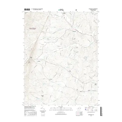
2016 Map of Churchville
USGS Topo · Published 2016About this map
Churchville serves as a central hub in this section of Augusta County, situated where Jennings Branch flows toward the Middle River. The landscape transitions from the dense timber of the George Washington National Forest along McKittricks Ridge in the northwest to a network of established family farms and small communities further south and east. Historic burial grounds like Crosby Cem, Green Hill Cem, and Hunters Cem are scattered across the terrain, reflecting generations of settlement near places like Lone Fountain and Swoope. The hydrological pattern is defined by the winding course of the Middle River, which passes near West View and Hebron, while smaller features like Trimbles Mill and Smithleigh Lake indicate local water use for industry and recreation in the early 21st century.
Find a feature on this map
105 named features on this map. Tap any name to fly to it.
Don’t see what you’re looking for? This feature index may not catch every label — zoom into the map to look around manually.
Map Details
Editions of this 2016 Churchville Map
This is the sole edition of this map. No revisions or reprints were ever made.
Other maps of this area

1894 · Staunton
USGS Topo · 1:125,000

1924 · Mc Dowell
USGS Topo · 1:62,500

1943 · Craigsville
USGS Topo · 1:62,500

1944 · Parnassus
USGS Topo · 1:62,500

1944 · Mc Dowell
USGS Topo · 1:62,500

1944 · Staunton
USGS Topo · 1:62,500

1945 · Craigsville
USGS Topo · 1:62,500

1946 · Mc Dowell
USGS Topo · 1:62,500

1947 · Staunton
USGS Topo · 1:62,500

1947 · Parnassus
USGS Topo · 1:62,500