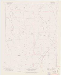
1972 Map of Cinco
USGS Topo · Published 1976About this map
Jawbone Canyon and the rugged landscape of the Fremont Valley define this portion of Kern County in the early 1970s. The map illustrates a high-desert environment where water management is paramount, shown by the dual paths of the Los Angeles Aqueduct and the Los Angeles Second Aqueduct carving through the terrain. Evidence of early 20th-century resource extraction remains visible in the presence of the Mohawk Buddy Mine, White Rock Mine, and various Prospects, while infrastructure like a Poleline and Flume indicate the technical efforts to power and water this arid region.
Find a feature on this map
30 named features on this map. Tap any name to fly to it.
Don’t see what you’re looking for? This feature index may not catch every label — zoom into the map to look around manually.
Map Details
Editions of this 1972 Cinco Map
3 editions found
Other maps of this area

1915 · Searles Lake
USGS Topo · 1:250,000

1915 · Mojave
USGS Topo · 1:125,000

1943 · Cross Mountain
USGS Topo · 1:62,500

1943 · Saltdale
USGS Topo · 1:62,500

1943 · Castle Butte
USGS Topo · 1:62,500

1943 · Mojave
USGS Topo · 1:62,500

1947 · Castle Butte
USGS Topo · 1:50,000

1947 · Trona
USGS Topo · 1:250,000

1948 · Trona
USGS Topo · 1:250,000

1948 · Bakersfield
USGS Topo · 1:250,000