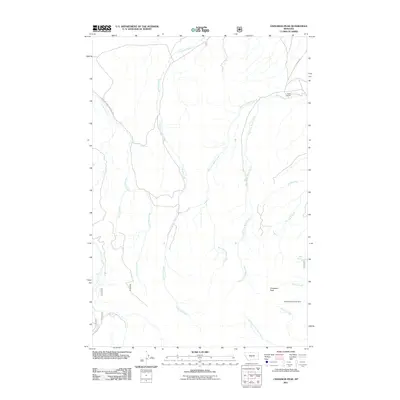
2011 Map of Cinnamon Peak
USGS Topo · Published 2011About this map
Cinnamon Peak rises over a landscape defined by an intricate network of drainage systems in Wheatland County. This 2011 survey shows the high-elevation terrain of the Lewis and Clark National Forest, where numerous creeks including Little Elk Creek, Lost Horse Creek, and West Fork Miller Creek carve through the foothills. The presence of the Pump Ranch in the northeast and the Twelvemile Coulee Dam to the south suggests a landscape managed for cattle and water resources. The detailed topography illustrates how water sources like Bear Spring and seasonal runs such as Buzzard Creek and Willow Creek dictate the layout of backcountry roads like 12W 885A Rd. This record provides researchers with a view of modern land use and forest boundaries in a rugged portion of the Montana range.
Find a feature on this map
22 named features on this map. Tap any name to fly to it.
Don’t see what you’re looking for? This feature index may not catch every label — zoom into the map to look around manually.
Map Details
Editions of this 2011 Cinnamon Peak Map
This is the sole edition of this map. No revisions or reprints were ever made.
Other maps of this area

1886 · Little Belt Mts.
USGS Topo · 1:250,000

1894 · Little Belt Mts.
USGS Topo · 1:250,000

1897 · Little Belt Mts.
USGS Topo · 1:250,000

1898 · Little Belt Mts.
USGS Topo · 1:250,000

1902 · Little Belt Mts.
USGS Topo · 1:250,000

1948 · White Sulphur Springs
USGS Topo · 1:250,000

1958 · White Sulphur Springs
USGS Topo · 1:250,000

1961 · White Sulphur Springs
USGS Topo · 1:250,000

1965 · White Sulphur Springs
USGS Topo · 1:250,000
1972 · Virginia Peak
USGS Topo · 1:24,000