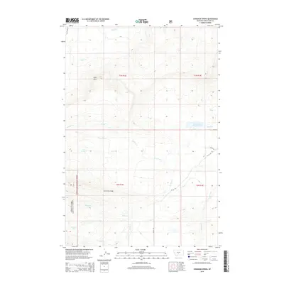
2014 Map of Cinnamon Spring
USGS Topo · Published 2014About this map
Lewis & Clark National Forest encompasses the southwestern corner of this Wheatland County landscape, defined by the prominent Jack Arthur Ridge and the heights of Coffin Butte. This high-altitude terrain is a critical watershed for the headwaters of numerous drainages including Miller Cr, Spring Cr, and Cinnamon Cr. The map reveals a land utilized for water management and remote access, centered on the Martin and C Bar J Reservoir near the eastern boundary. The presence of the namesake Cinnamon Spring in the southwest highlights the importance of reliable water sources in this cattle-country environment. The road network is sparse, consisting of few established routes like Big Elk Rd and Leppink Rd that navigate the drainages of Big Elk Cr and Bear Cr, illustrating the vast, unpopulated nature of this portion of central Montana.
Find a feature on this map
21 named features on this map. Tap any name to fly to it.
Don’t see what you’re looking for? This feature index may not catch every label — zoom into the map to look around manually.
Map Details
Editions of this 2014 Cinnamon Spring Map
This is the sole edition of this map. No revisions or reprints were ever made.
Other maps of this area

1886 · Little Belt Mts.
USGS Topo · 1:250,000

1894 · Little Belt Mts.
USGS Topo · 1:250,000

1897 · Little Belt Mts.
USGS Topo · 1:250,000

1898 · Little Belt Mts.
USGS Topo · 1:250,000

1902 · Little Belt Mts.
USGS Topo · 1:250,000

1948 · White Sulphur Springs
USGS Topo · 1:250,000

1958 · White Sulphur Springs
USGS Topo · 1:250,000

1961 · White Sulphur Springs
USGS Topo · 1:250,000

1965 · White Sulphur Springs
USGS Topo · 1:250,000
1972 · Lebo Lake
USGS Topo · 1:24,000