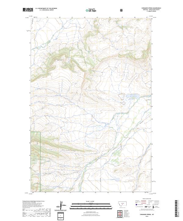
2024 Map of Cinnamon Spring
USGS Topo · Published 2024About this map
Cinnamon Spring and the Martin and C Bar J Reservoir anchor this section of Wheatland County, where the plains give way to the foothills of the Lewis & Clark National Forest. The landscape is defined by a series of prominent rises including Coffin Butte and the long stretch of Jack Arthur Ridge, which serve as watersheds for a complex network of drainages. Numerous seasonal and perennial streams, such as Miller Creek, Station Creek, and Big Elk Creek, carve through the terrain, indicating the vital importance of water management in this ranching country.
Find a feature on this map
23 named features on this map. Tap any name to fly to it.
Don’t see what you’re looking for? This feature index may not catch every label — zoom into the map to look around manually.
Map Details
Editions of this 2024 Cinnamon Spring Map
This is the sole edition of this map. No revisions or reprints were ever made.
Other maps of this area

1886 · Little Belt Mts.
USGS Topo · 1:250,000

1894 · Little Belt Mts.
USGS Topo · 1:250,000

1897 · Little Belt Mts.
USGS Topo · 1:250,000

1898 · Little Belt Mts.
USGS Topo · 1:250,000

1902 · Little Belt Mts.
USGS Topo · 1:250,000

1948 · White Sulphur Springs
USGS Topo · 1:250,000

1958 · White Sulphur Springs
USGS Topo · 1:250,000

1961 · White Sulphur Springs
USGS Topo · 1:250,000

1965 · White Sulphur Springs
USGS Topo · 1:250,000
1972 · Lebo Lake
USGS Topo · 1:24,000