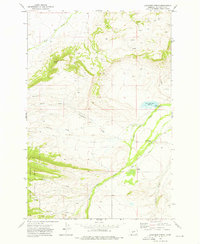
1972 Map of Cinnamon Spring
USGS Topo · Published 1976About this map
Lewis and Clark National Forest defines the western edge of this Wheatland County landscape, where the high country gives way to a network of drainage systems and ranching operations. The terrain is marked by the prominent Coffin Butte and bisected by numerous waterways including Big Elk Creek, Bear Creek, and Cinnamon Creek. Mapping here in the early 1970s reveals a sparse but established agricultural footprint, with specific family holdings and named operations like the McFarland-White Ranch and Top Hat Ranch situated along the valley floors.
Find a feature on this map
17 named features on this map. Tap any name to fly to it.
Don’t see what you’re looking for? This feature index may not catch every label — zoom into the map to look around manually.
Map Details
Editions of this 1972 Cinnamon Spring Map
This is the sole edition of this map. No revisions or reprints were ever made.
Other maps of this area

1886 · Little Belt Mts.
USGS Topo · 1:250,000

1894 · Little Belt Mts.
USGS Topo · 1:250,000

1897 · Little Belt Mts.
USGS Topo · 1:250,000

1898 · Little Belt Mts.
USGS Topo · 1:250,000

1902 · Little Belt Mts.
USGS Topo · 1:250,000

1948 · White Sulphur Springs
USGS Topo · 1:250,000

1958 · White Sulphur Springs
USGS Topo · 1:250,000

1961 · White Sulphur Springs
USGS Topo · 1:250,000

1965 · White Sulphur Springs
USGS Topo · 1:250,000
1972 · Lebo Lake
USGS Topo · 1:24,000