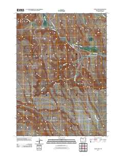
2011 Map of Circle Bar
USGS Topo · Published 2011About this map
Circle Bar Ranch and the community of Circle Bar anchor this rural landscape in Harney County, characterized by a complex network of waterways and ranching operations. The terrain is defined by the high, flat reaches of the Beaver Tables and the seasonal flows of Crane Creek and Beaver Creek. Human impact on the hydrology is evident through features like Fister Ditch, which redirects water to support the agricultural needs of the high desert. Local travel is facilitated by the Riverside Rd and Crane-Venator Rd, providing essential connections between isolated homesteads such as Miller Ranch and Hamilton Ranch. This documentation captures the persistent ranching culture and the critical relationship between land management and water resources in this portion of the Oregon backcountry.
Find a feature on this map
13 named features on this map. Tap any name to fly to it.
Don’t see what you’re looking for? This feature index may not catch every label — zoom into the map to look around manually.
Map Details
Editions of this 2011 Circle Bar Map
This is the sole edition of this map. No revisions or reprints were ever made.
Other maps of this area

1955 · Burns
USGS Topo · 1:250,000

1958 · Burns
USGS Topo · 1:250,000

1959 · Burns
USGS Topo · 1:250,000

1960 · Crane
USGS Topo · 1:62,500

1967 · Adobe Flat
USGS Topo · 1:24,000

1968 · Venator
USGS Topo · 1:62,500

1972 · Circle Bar
USGS Topo · 1:24,000

1972 · Venator
USGS Topo · 1:24,000
1972 · Dunnean
USGS Topo · 1:24,000
1972 · Tin Can Ridge
USGS Topo · 1:24,000