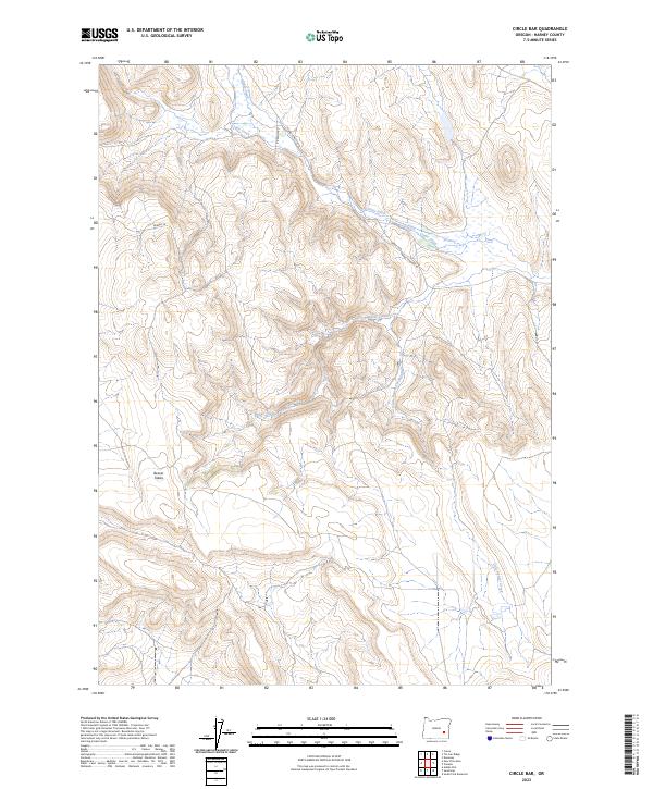
2023 Map of Circle Bar
USGS Topo · Published 2023About this map
Beaver Tables rises as a prominent high-ground landform in this high-desert portion of Harney County, characterized by a complex drainage system. The hydrology of the area is defined by the winding paths of Beaver Creek and Little Beaver Creek, which carve through the arid terrain. To the north, Crane Creek is supplemented by the Fister Ditch, indicating the historical management of water for ranching or agricultural purposes in this dry landscape. Transportation is limited to a few established routes such as Riverside Rd and Crane-Venator Rd, which connect these remote ranges. The map provides a detailed view of the township and range survey system, including t26s r34e and t26s r35e, offering a precise spatial framework for land ownership and historical land use research in the region.
Find a feature on this map
14 named features on this map. Tap any name to fly to it.
Don’t see what you’re looking for? This feature index may not catch every label — zoom into the map to look around manually.
Map Details
Editions of this 2023 Circle Bar Map
This is the sole edition of this map. No revisions or reprints were ever made.
Other maps of this area

1955 · Burns
USGS Topo · 1:250,000

1958 · Burns
USGS Topo · 1:250,000

1959 · Burns
USGS Topo · 1:250,000

1960 · Crane
USGS Topo · 1:62,500

1967 · Adobe Flat
USGS Topo · 1:24,000

1968 · Venator
USGS Topo · 1:62,500

1972 · Circle Bar
USGS Topo · 1:24,000

1972 · Venator
USGS Topo · 1:24,000
1972 · Dunnean
USGS Topo · 1:24,000
1972 · Tin Can Ridge
USGS Topo · 1:24,000