1983 Map of Circle Reservoir
USGS Topo · Published 1983About this map
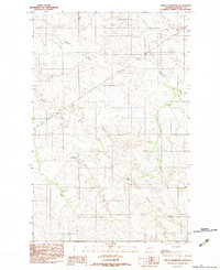
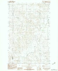
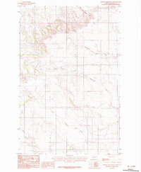
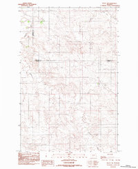
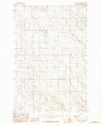
Sullivan Creek and Alkali Creek carve through this eastern Montana landscape, reflecting the intricate drainage patterns of the high plains in Dawson County. The central feature is Circle Reservoir, an essential water resource for this arid ranching and farming region. The map reveals the stark topography of the area, defined by the confluence of Pasture Creek and its distinctive East Fork and West Fork branches. These watercourses dictate the layout of unimproved roads and trails across the terrain, illustrating the remote and functional nature of the land use in the early 1980s. This survey, based on 1970s aerial photography and 1983 field checks, preserves the exact footprint of water management and local drainage before modern agricultural shifts.
Find a feature on this map
6 named features on this map. Tap any name to fly to it.
Don’t see what you’re looking for? This feature index may not catch every label — zoom into the map to look around manually.
Map Details
Editions of this 1983 Circle Reservoir Map
This is the sole edition of this map. No revisions or reprints were ever made.
Other maps of this area

1954 · Glendive
USGS Topo · 1:250,000

1957 · Glendive
USGS Topo · 1:250,000

1958 · Glendive
USGS Topo · 1:250,000
1982 · Circle
USGS Topo · 1:100,000
1983 · Johnson Reservoir NW
USGS Topo · 1:24,000
1983 · Richey
USGS Topo · 1:24,000
1983 · Buffalo Creek NE
USGS Topo · 1:24,000
1983 · Johnson Reservoir NE
USGS Topo · 1:24,000
1983 · Richey NW
USGS Topo · 1:24,000
1983 · Olson Coulee North
USGS Topo · 1:24,000