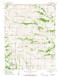
1961 Map of Circleville
USGS Topo · Published 1962About this map
Circleville serves as the primary hub in this early 1960s topographic survey, which spans the border of Nemaha Co Jackson Co. The landscape is defined by the drainage patterns of several winding waterways, including Spring Creek, Mosquito Creek, and Straight Creek. The Missouri Pacific railroad cuts through the northeastern corner, indicating the vital transit corridor connecting small prairie communities. In Liberty and Jefferson townships, the map reveals a rural social infrastructure, noting the Grange Hall and Pleasant Grove Ch. Local industry is represented by a Gravel Pit, while the Circleville Cem provides a focal point for genealogical research. This map offers a clear view of the land before significant modern development, showing the distribution of farmsteads and the precise contours of the creek valleys.
Find a feature on this map
16 named features on this map. Tap any name to fly to it.
Don’t see what you’re looking for? This feature index may not catch every label — zoom into the map to look around manually.
Map Details
Editions of this 1961 Circleville Map
This is the sole edition of this map. No revisions or reprints were ever made.
Other maps of this area

1888 · Hiawatha
USGS Topo · 1:125,000

1889 · Topeka
USGS Topo · 1:125,000

1894 · Topeka
USGS Topo · 1:125,000

1894 · Hiawatha
USGS Topo · 1:125,000

1950 · Kansas City
USGS Topo · 1:250,000

1954 · Kansas City
USGS Topo · 1:250,000

1956 · Kansas City
USGS Topo · 1:250,000

1960 · Kansas City
USGS Topo · 1:250,000
1960 · Holton
USGS Topo · 1:24,000
1960 · Horton NW
USGS Topo · 1:24,000