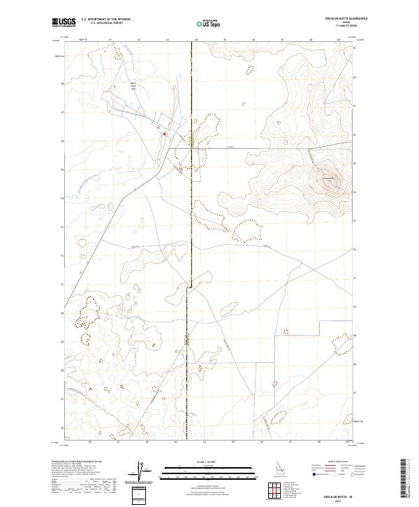
2023 Map of Circular Butte
USGS Topo · Published 2023About this map
Circular Butte dominates the northeastern landscape of this high desert region along the border of Butte and Jefferson counties. This modern topographic survey illustrates a complex hydrologic network where surface water often disappears into the basalt-rich earth, most notably at the Birch Creek Sinks. The northern reaches of the map show Birch Creek transitioning into these terminal sinks, while the western section is marked by the Dry Channel Big Lost River, reflecting the seasonal and subterranean nature of water in the Snake River Plain.
Find a feature on this map
19 named features on this map. Tap any name to fly to it.
Don’t see what you’re looking for? This feature index may not catch every label — zoom into the map to look around manually.
Map Details
Editions of this 2023 Circular Butte Map
This is the sole edition of this map. No revisions or reprints were ever made.
Other maps of this area

1955 · Idaho Falls
USGS Topo · 1:250,000

1958 · Idaho Falls
USGS Topo · 1:250,000

1969 · Antelope Butte
USGS Topo · 1:24,000

1969 · Circular Butte
USGS Topo · 1:24,000

1969 · Circular Butte NW
USGS Topo · 1:24,000

1969 · Richard Butte
USGS Topo · 1:24,000
1969 · Monteview
USGS Topo · 1:24,000

1969 · Big Lost River Sinks
USGS Topo · 1:24,000

1973 · Little Butte NE
USGS Topo · 1:24,000

1973 · Little Butte NW
USGS Topo · 1:24,000