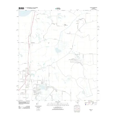
2012 Map of Citra
USGS Topo · Published 2012About this map
Citra and Island Grove anchor this Florida landscape, where the flatlands of Marion County meet a complex network of wetlands and citrus-era history. The map detail highlights the hydrological connection between Orange Lake and Lochloosa Lake via the Lochloosa Slough, a corridor defined by numerous smaller basins like Still Pond and Simmons Pond. This area is notable for its aviation and literary associations, featuring the Marjorie Kennan Rawlings Airport and the smaller 85th Avenue Airstrip. Genealogists will find a high density of burial sites for the local population, including Citra Cemetery, Antioch Cemetery, and Carlton Cemetery. The terrain is characterized by the California Scrub, reflecting the unique sandy ecosystems of the region. A dense grid of rural roads and residential lanes, such as NE 189th Ln and NE 200th Street Rd, shows the modern footprint of these established agricultural communities.
Find a feature on this map
92 named features on this map. Tap any name to fly to it.
Don’t see what you’re looking for? This feature index may not catch every label — zoom into the map to look around manually.
Map Details
Editions of this 2012 Citra Map
This is the sole edition of this map. No revisions or reprints were ever made.
Other maps of this area

1893 · Citra
USGS Topo · 1:62,500

1895 · Citra
USGS Topo · 1:62,500

1915 · Interlachen
USGS Topo · 1:48,000

1916 · Interlachen
USGS Topo · 1:62,500

1938 · Hawthorn
USGS Topo · 1:48,000

1943 · Hawthorn
USGS Topo · 1:62,500

1944 · Interlachen
USGS Topo · 1:62,500

1949 · Keuka
USGS Topo · 1:24,000

1949 · Interlachen
USGS Topo · 1:62,500

1954 · Gainesville
USGS Topo · 1:250,000