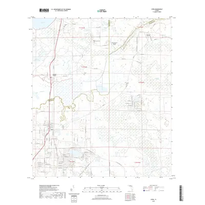
2018 Map of Citra
USGS Topo · Published 2018About this map
Lochloosa Lake and Orange Lake dominate the hydrography of this North Central Florida corridor, where the boundaries of Alachua, Marion, and Putnam counties converge. The settlement of Citra serves as a local hub near the southern edge, while Island Grove sits further north along the Lochloosa Slough. This area is characterized by its extensive wetlands and distinct prairie landscapes, most notably the Black Sink Prairie and the California Scrub terrain.
Find a feature on this map
66 named features on this map. Tap any name to fly to it.
Don’t see what you’re looking for? This feature index may not catch every label — zoom into the map to look around manually.
Map Details
Editions of this 2018 Citra Map
This is the sole edition of this map. No revisions or reprints were ever made.
Other maps of this area

1893 · Citra
USGS Topo · 1:62,500

1895 · Citra
USGS Topo · 1:62,500

1915 · Interlachen
USGS Topo · 1:48,000

1916 · Interlachen
USGS Topo · 1:62,500

1938 · Hawthorn
USGS Topo · 1:48,000

1943 · Hawthorn
USGS Topo · 1:62,500

1944 · Interlachen
USGS Topo · 1:62,500

1949 · Keuka
USGS Topo · 1:24,000

1949 · Interlachen
USGS Topo · 1:62,500

1954 · Gainesville
USGS Topo · 1:250,000