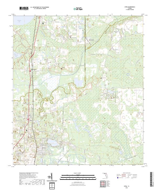
2024 Map of Citra
USGS Topo · Published 2024About this map
Island Grove and Citra anchor the western edge of this Marion County corridor, where the landscape transitions from the open waters of Lochloosa Lake into a network of wetlands and prairies. The map details a region defined by its water management and conservation history, featuring the Orange Creek Restoration Area Trl and the broad reaches of Black Sink Prairie. Local history is preserved through numerous family and community burial grounds, including Antioch Cem, Carlton Cem, and Simmons Cem, which are scattered among the orange groves and hammocks.
Find a feature on this map
67 named features on this map. Tap any name to fly to it.
Don’t see what you’re looking for? This feature index may not catch every label — zoom into the map to look around manually.
Map Details
Editions of this 2024 Citra Map
This is the sole edition of this map. No revisions or reprints were ever made.
Other maps of this area

1893 · Citra
USGS Topo · 1:62,500

1895 · Citra
USGS Topo · 1:62,500

1915 · Interlachen
USGS Topo · 1:48,000

1916 · Interlachen
USGS Topo · 1:62,500

1938 · Hawthorn
USGS Topo · 1:48,000

1943 · Hawthorn
USGS Topo · 1:62,500

1944 · Interlachen
USGS Topo · 1:62,500

1949 · Keuka
USGS Topo · 1:24,000

1949 · Interlachen
USGS Topo · 1:62,500

1954 · Gainesville
USGS Topo · 1:250,000