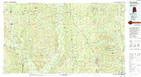
1984 Map of Citronelle
USGS Topo · Published 1994About this map
The Chickasawhay River and Leaf River define the lower piney woods landscape of this 1984 survey, which spans the border between Mississippi and Alabama. This region is characterized by extensive managed woodlands, including the Desoto National Forest and several state wildlife areas. A significant industrial footprint is visible through the Oil Field near Citronelle and the active corridor of the Illinois Central Gulf RR, which links timber and trade towns like Leakesville and Wagarville.
Find a feature on this map
60 named features on this map. Tap any name to fly to it.
Don’t see what you’re looking for? This feature index may not catch every label — zoom into the map to look around manually.
Map Details
Editions of this 1984 Citronelle Map
2 editions found
Other maps of this area

1941 · Bay Minette
USGS Topo · 1:62,500

1941 · Creola
USGS Topo · 1:62,500

1941 · Lucedale
USGS Topo · 1:62,500

1942 · Deer Park
USGS Topo · 1:62,500

1942 · Wilmer
USGS Topo · 1:62,500

1943 · Lucedale
USGS Topo · 1:62,500

1943 · Creola
USGS Topo · 1:62,500

1943 · Bay Minette
USGS Topo · 1:62,500

1943 · Deer Park
USGS Topo · 1:62,500

1943 · Choctaw Bluff
USGS Topo · 1:62,500