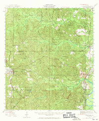
1943 Map of Citronelle
USGS Topo · Published 1970About this map
Citronelle and the surrounding piney woods of northern Mobile County are captured here during the early 1940s, showing a landscape defined by its timber and rail connections. The Alabama Tennessee and Northern Railroad and the Southern Railway parallel each other through the eastern wetlands, linking river settlements like Mt Vernon and Chastang to the broader regional economy. The presence of the Searcy State Hospital and the nearby Mobile River bottomlands highlights the distinct social and natural geography of this river corridor.
Find a feature on this map
83 named features on this map. Tap any name to fly to it.
Don’t see what you’re looking for? This feature index may not catch every label — zoom into the map to look around manually.
Map Details
Editions of this 1943 Citronelle Map
2 editions found
Other maps of this area

1941 · Bay Minette
USGS Topo · 1:62,500

1941 · Creola
USGS Topo · 1:62,500

1942 · Deer Park
USGS Topo · 1:62,500

1942 · Wilmer
USGS Topo · 1:62,500

1943 · Creola
USGS Topo · 1:62,500

1943 · Bay Minette
USGS Topo · 1:62,500

1943 · Deer Park
USGS Topo · 1:62,500

1943 · Choctaw Bluff
USGS Topo · 1:62,500

1943 · Tensaw
USGS Topo · 1:62,500

1943 · Citronelle
USGS Topo · 1:62,500