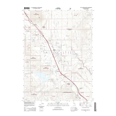
2015 Map of City of Mount Shasta
USGS Topo · Published 2015About this map
The Sacramento River headwaters and the massive volcanic profile of Black Butte anchor this 2015 survey of the Mount Shasta region. The landscape is defined by the steep transitions between the Shasta National Forest and the developed corridors of the Union Pacific railroad and Interstate 5. Significant water features such as Siskiyou Lake and the Big Springs aquifer system illustrate the hydraulic character of the area, while smaller settlements like Pioneer, Azalea, and Mott trace the historic path of transit and industry south toward Dunsmuir. Local history is preserved at Mount Shasta Memorial Park, and the map details the modern residential expansion into the hills via Upton Rd and Siskiyou Lake Blvd. From the high elevations of Rainbow Ridge to the depths of Box Canyon, the map provides a contemporary record of this alpine community's infrastructure and natural surroundings.
Find a feature on this map
111 named features on this map. Tap any name to fly to it.
Don’t see what you’re looking for? This feature index may not catch every label — zoom into the map to look around manually.
Map Details
Editions of this 2015 City of Mount Shasta Map
This is the sole edition of this map. No revisions or reprints were ever made.
Other maps of this area

1886 · Shasta
USGS Topo · 1:250,000

1894 · Shasta
USGS Topo · 1:250,000

1935 · Dunsmuir
USGS Topo · 1:125,000

1948 · Weed
USGS Topo · 1:250,000

1950 · Weed
USGS Topo · 1:250,000

1954 · Shoeinhorse Mountain
USGS Topo · 1:62,500

1954 · Shasta
USGS Topo · 1:62,500

1954 · Weed
USGS Topo · 1:62,500

1954 · Dunsmuir
USGS Topo · 1:62,500

1958 · Weed
USGS Topo · 1:250,000