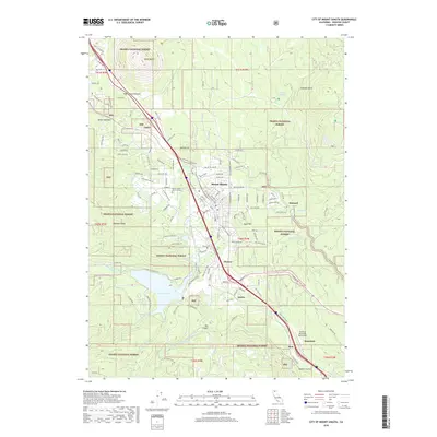
2018 Map of City of Mount Shasta
USGS Topo · Published 2018About this map
Mount Shasta is positioned at the base of the prominent volcanic landmark Black Butte, with its urban layout defined by the Union Pacific Railroad corridor. The community of Mount Shasta and its surrounding neighborhoods like Upton, Spring Hill, and Pioneer are framed by the extensive timberlands of the Shasta National Forest. Water is a defining element of this high-elevation landscape, from the expansive Lake Siskiyou to the natural outflow of Big Springs and Big Springs Creek. Southward, the map follows the canyon of the Sacramento River through Azalea toward the historic rail-oriented settlement of Mott and the Dunsmuir-Mott Airport. This modern survey documents a topography where infrastructure is deeply integrated into the watershed, featuring numerous seasonal creeks such as Cold Creek and Scott Camp Creek that drain the slopes of Rainbow Ridge and Quail Hill.
Find a feature on this map
137 named features on this map. Tap any name to fly to it.
Don’t see what you’re looking for? This feature index may not catch every label — zoom into the map to look around manually.
Map Details
Editions of this 2018 City of Mount Shasta Map
This is the sole edition of this map. No revisions or reprints were ever made.
Other maps of this area

1886 · Shasta
USGS Topo · 1:250,000

1894 · Shasta
USGS Topo · 1:250,000

1935 · Dunsmuir
USGS Topo · 1:125,000

1948 · Weed
USGS Topo · 1:250,000

1950 · Weed
USGS Topo · 1:250,000

1954 · Shoeinhorse Mountain
USGS Topo · 1:62,500

1954 · Shasta
USGS Topo · 1:62,500

1954 · Weed
USGS Topo · 1:62,500

1954 · Dunsmuir
USGS Topo · 1:62,500

1958 · Weed
USGS Topo · 1:250,000