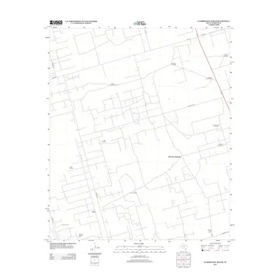
2012 Map of Clabber Hill Ranch
USGS Topo · Published 2012About this map
The Emma Oil Field and Andrews South Oil Field dominate the industrial footprint of this West Texas landscape, where energy extraction meets traditional ranching operations. In this arid reach of Andrews County, the survival of the Clabber Hill Ranch is inextricably tied to a network of water sources, each marked by distinctive names such as the Rock Tank Windmill, Jackson Parker Windmill, and Old Place Windmills.
Find a feature on this map
22 named features on this map. Tap any name to fly to it.
Don’t see what you’re looking for? This feature index may not catch every label — zoom into the map to look around manually.
Map Details
Editions of this 2012 Clabber Hill Ranch Map
This is the sole edition of this map. No revisions or reprints were ever made.
Other maps of this area

1954 · Hobbs
USGS Topo · 1:250,000

1958 · Hobbs
USGS Topo · 1:250,000

1963 · Andrews
USGS Topo · 1:24,000

1967 · North Cowden
USGS Topo · 1:24,000

1968 · Coyote Corner
USGS Topo · 1:24,000

1968 · North Cowden NW
USGS Topo · 1:24,000

1968 · Gardendale NW
USGS Topo · 1:24,000

1968 · Clabber Hill Ranch
USGS Topo · 1:24,000
1968 · Gardendale
USGS Topo · 1:24,000
1971 · Five Wells Ranch SW
USGS Topo · 1:24,000