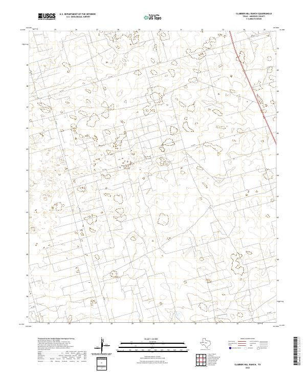
2022 Map of Clabber Hill Ranch
USGS Topo · Published 2022About this map
Andrews County, Texas, is characterized by a sprawling network of ranch roads and section lines that define the local economy and land use. The US Route 385 corridor serves as the primary north-south artery through this landscape, connecting the modern ranching operations and industrial activities that dominate the region. The map reveals a structured grid of rural infrastructure, with roads like Sw 5000 and Sw 5900 cutting across the terrain to facilitate access to various properties and resource sites. This modern topographic study shows the systematic organization of land in West Texas, where movement is dictated by these long, straight stretches of roadway such as SW 1001 and Sw 1201. These pathways reflect the persistent importance of transport in maintaining the connectivity of isolated ranch lands and industrial plots far from the county seat.
Find a feature on this map
9 named features on this map. Tap any name to fly to it.
Don’t see what you’re looking for? This feature index may not catch every label — zoom into the map to look around manually.
Map Details
Editions of this 2022 Clabber Hill Ranch Map
This is the sole edition of this map. No revisions or reprints were ever made.
Other maps of this area

1954 · Hobbs
USGS Topo · 1:250,000

1958 · Hobbs
USGS Topo · 1:250,000

1963 · Andrews
USGS Topo · 1:24,000

1967 · North Cowden
USGS Topo · 1:24,000

1968 · Coyote Corner
USGS Topo · 1:24,000

1968 · North Cowden NW
USGS Topo · 1:24,000

1968 · Gardendale NW
USGS Topo · 1:24,000

1968 · Clabber Hill Ranch
USGS Topo · 1:24,000
1968 · Gardendale
USGS Topo · 1:24,000
1971 · Five Wells Ranch SW
USGS Topo · 1:24,000