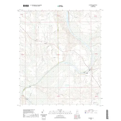
2020 Map of Claiborne
USGS Topo · Published 2020About this map
The Alabama River carves a winding path through this region of Clarke and Monroe Counties, defining a landscape shaped by river transport and floodplain ecology. Near the settlement of Gosport, the river’s influence is evident in the numerous bars and creeks, such as Mistress Gray Bar and Pigeon Creek Bar, which once served as vital navigational markers and local landmarks. This modern survey reflects the continuity of land use in southwest Alabama, where large managed water bodies like Mabel Bedsole Ward Trust Lake and W D Harrigan and Eunice Woods Lake dominate the northern and central reaches. The area's transportation history is anchored by the Claiborne-Murphy Bridge crossing near Alabama Heights, connecting the dispersed rural communities and family-named roads. Genealogists will find the locations of the Claiborne Cem and McConnico Cem useful for tracing local family lineages in this riverine corridor.
Find a feature on this map
48 named features on this map. Tap any name to fly to it.
Don’t see what you’re looking for? This feature index may not catch every label — zoom into the map to look around manually.
Map Details
Editions of this 2020 Claiborne Map
This is the sole edition of this map. No revisions or reprints were ever made.
Other maps of this area

1953 · Andalusia
USGS Topo · 1:250,000

1957 · Andalusia
USGS Topo · 1:250,000

1972 · Frisco City
USGS Topo · 1:24,000

1972 · Franklin
USGS Topo · 1:24,000

1972 · Mexia
USGS Topo · 1:24,000

1972 · Flynns Lake
USGS Topo · 1:24,000

1972 · Whatley
USGS Topo · 1:24,000

1972 · Gainestown
USGS Topo · 1:24,000

1972 · Claiborne
USGS Topo · 1:24,000

1972 · Suggsville
USGS Topo · 1:24,000