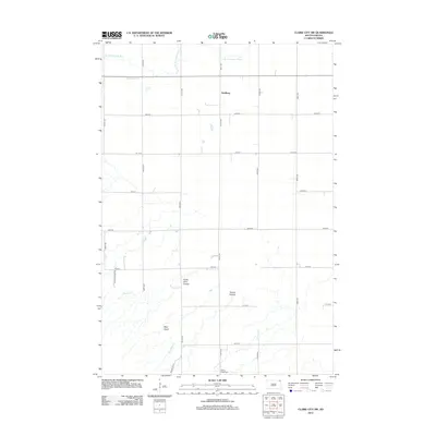
2012 Map of Claire City SW
USGS Topo · Published 2012About this map
The Little Minnesota River meanders through this portion of Marshall and Roberts Counties, defining a landscape of northern plains drainage and agricultural section lines. This 2012 survey shows the small settlement of Dahlberg centrally located amidst an extensive network of rural roads such as 451st Ave and 106th St. The terrain is characterized by distinct coulees and gulches that break the flat prairie, including the notably named Uncle John Coulee and the dramatic depression of Sieche Hollow. Local heritage is anchored by sites like the Spring Valley Cem, while the inclusion of Indian Rte 10 and Canyon Ranch Rd reflects the modern infrastructure connecting these remote landholdings. Smaller tributaries like Munson Cr, LaFrambois Cr, and Standfast Cr further illustrate the hydrology of the upper Minnesota River basin.
Find a feature on this map
24 named features on this map. Tap any name to fly to it.
Don’t see what you’re looking for? This feature index may not catch every label — zoom into the map to look around manually.
Map Details
Editions of this 2012 Claire City SW Map
This is the sole edition of this map. No revisions or reprints were ever made.
Other maps of this area

1953 · Milbank
USGS Topo · 1:250,000

1958 · Milbank
USGS Topo · 1:250,000

1958 · Veblen
USGS Topo · 1:24,000

1958 · Veblen NE
USGS Topo · 1:24,000
1964 · Claire City NE
USGS Topo · 1:24,000
1964 · Claire City NW
USGS Topo · 1:24,000

1964 · Claire City
USGS Topo · 1:24,000

1964 · Claire City SW
USGS Topo · 1:24,000

1970 · Whitestone Lake
USGS Topo · 1:24,000

1970 · Sisseton
USGS Topo · 1:24,000