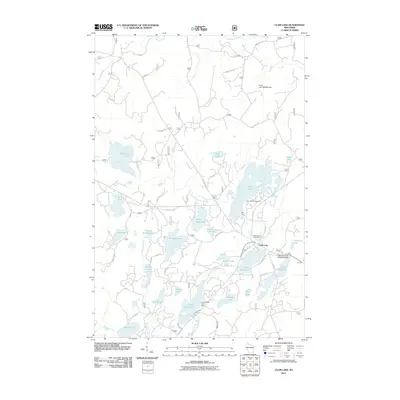
2011 Map of Clam Lake
USGS Topo · Published 2011About this map
The West Fork Chippewa River meanders through this heavily forested landscape, defining a region where water management and recreation are central to its character. At Clam Lake, the presence of the Little Clam Lake Seaplane Base highlights a unique mode of transportation necessary for navigating the remote lake-dotted terrain. The landscape is punctuated by numerous glacial lakes including Chippewa Lake, Day Lake, and Buffalo Lake, many of which are regulated by structures like the Day Dam and Lower Clam Lake Dam.
Find a feature on this map
88 named features on this map. Tap any name to fly to it.
Don’t see what you’re looking for? This feature index may not catch every label — zoom into the map to look around manually.
Map Details
Editions of this 2011 Clam Lake Map
This is the sole edition of this map. No revisions or reprints were ever made.
Other maps of this area

1942 · Clam Lake
USGS Topo · 1:48,000

1942 · Marengo
USGS Topo · 1:48,000

1943 · Namekagon Lake
USGS Topo · 1:48,000

1944 · Grandview
USGS Topo · 1:48,000

1945 · Namekagon Lake
USGS Topo · 1:48,000

1945 · Marengo
USGS Topo · 1:48,000

1945 · Clam Lake
USGS Topo · 1:48,000

1947 · Grandview
USGS Topo · 1:48,000

1953 · Ashland
USGS Topo · 1:250,000

1958 · Ashland
USGS Topo · 1:250,000