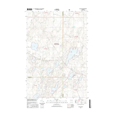
2015 Map of Clam Lake
USGS Topo · Published 2015About this map
Chequamegon National Forest surrounds the small community of Clam Lake, where the W Fork Chippewa River drains a complex glacial landscape of kettle lakes and wetlands. The settlement sits at a crossroads of forest roads and county highways, serving as a remote hub near Upper Clam Lake and Little Clam Lake. The terrain is characterized by its high density of named water bodies, ranging from the large Day Lake to the smaller, secluded Muskie Springs Lake and White Bass Lake. A notable point of local history is the Wildwood Cem, located just north of the village. The intersection of Co Hwy GG and E Stuebe Rd highlights the local transportation network that supports the region's logging and recreational legacy in the Northwoods.
Find a feature on this map
47 named features on this map. Tap any name to fly to it.
Don’t see what you’re looking for? This feature index may not catch every label — zoom into the map to look around manually.
Map Details
Editions of this 2015 Clam Lake Map
This is the sole edition of this map. No revisions or reprints were ever made.
Other maps of this area

1942 · Clam Lake
USGS Topo · 1:48,000

1942 · Marengo
USGS Topo · 1:48,000

1943 · Namekagon Lake
USGS Topo · 1:48,000

1944 · Grandview
USGS Topo · 1:48,000

1945 · Namekagon Lake
USGS Topo · 1:48,000

1945 · Marengo
USGS Topo · 1:48,000

1945 · Clam Lake
USGS Topo · 1:48,000

1947 · Grandview
USGS Topo · 1:48,000

1953 · Ashland
USGS Topo · 1:250,000

1958 · Ashland
USGS Topo · 1:250,000