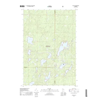
2018 Map of Clam Lake
USGS Topo · Published 2018About this map
Chequamegon National Forest encompasses the vast majority of this landscape, where the settlement of Clam Lake sits as a central hub for the surrounding Northwoods. The geography is defined by a dense network of glacial lakes and wetlands, connected by the meandering W Fork Chippewa River. The community's history and local heritage are anchored near the waters of Upper Clam Lake and Lower Clam Lake 16, with the Wildwood Cem providing a quiet record of early residents in this timber and recreation region.
Find a feature on this map
35 named features on this map. Tap any name to fly to it.
Don’t see what you’re looking for? This feature index may not catch every label — zoom into the map to look around manually.
Map Details
Editions of this 2018 Clam Lake Map
This is the sole edition of this map. No revisions or reprints were ever made.
Other maps of this area

1942 · Clam Lake
USGS Topo · 1:48,000

1942 · Marengo
USGS Topo · 1:48,000

1943 · Namekagon Lake
USGS Topo · 1:48,000

1944 · Grandview
USGS Topo · 1:48,000

1945 · Namekagon Lake
USGS Topo · 1:48,000

1945 · Marengo
USGS Topo · 1:48,000

1945 · Clam Lake
USGS Topo · 1:48,000

1947 · Grandview
USGS Topo · 1:48,000

1953 · Ashland
USGS Topo · 1:250,000

1958 · Ashland
USGS Topo · 1:250,000