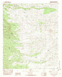
1982 Map of Clanton Draw
USGS Topo · Published 1982About this map
The Coronado National Forest dominates this section of Hidalgo County, where the desert floor meets significant mountain drainage systems. The landscape is defined by deep incisions like Skeleton Canyon and Dutchman Canyon, which channel seasonal water toward the east. This 1982 provisional survey reveals the essential role of water management in this arid region, documented through a dense network of man-made catchment basins including Patterson Tank, Cowan Tank, and Maddox Tank. These features reflect the area's primary use for livestock grazing, providing vital infrastructure for ranchers navigating the complex topography between Deer Flat and the headwaters of Animas Creek. The presence of named landmarks like Horse Camp Draw and Whitmire Canyon underscores the historic movement of people and cattle through these corridors long before modern mapping.
Find a feature on this map
26 named features on this map. Tap any name to fly to it.
Don’t see what you’re looking for? This feature index may not catch every label — zoom into the map to look around manually.
Map Details
Editions of this 1982 Clanton Draw Map
2 editions found
Other maps of this area

1917 · Chiricahua
USGS Topo · 1:125,000

1918 · Cienega Springs
USGS Topo · 1:62,500

1918 · Animas Peak
USGS Topo · 1:62,500

1919 · Perilla
USGS Topo · 1:125,000

1919 · Chiricahua
USGS Topo · 1:125,000

1920 · Animas Peak
USGS Topo · 1:62,500

1922 · McDonald
USGS Topo · 1:62,500

1940 · Apache
USGS Topo · 1:62,500

1955 · Douglas
USGS Topo · 1:250,000

1958 · Apache
USGS Topo · 1:62,500