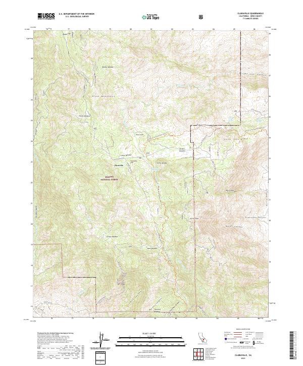
2021 Map of Claraville
USGS Topo · Published 2021About this map
Claraville sits at the heart of this high-elevation landscape within the Sequoia National Forest, representing a remote settlement pocket in the Piute Mountains. The area is characterized by a high-altitude network of meadows and flats, including Claraville Flat, Weldon Meadow, and Lomar Meadow, which historically supported seasonal grazing and mining operations. Evidence of early extractive industry remains via the Franceschi Mine and the Waterhole Mine Spring. Modern recreational use is represented by the Pacific Crest National Scenic Trl, which winds through the Sierra Nevada terrain past Sorrell Peak and Saint John Ridge. The geography is defined by deep drainages like Smith Canyon and Kelso Valley, while access remains limited to rugged routes like Piute Mountain Rd and Jawbone Canyon Rd.
Find a feature on this map
46 named features on this map. Tap any name to fly to it.
Don’t see what you’re looking for? This feature index may not catch every label — zoom into the map to look around manually.
Map Details
Editions of this 2021 Claraville Map
This is the sole edition of this map. No revisions or reprints were ever made.
Other maps of this area

1906 · Kernville
USGS Topo · 1:125,000

1908 · Kernville
USGS Topo · 1:125,000

1915 · Mojave
USGS Topo · 1:125,000

1943 · Cross Mountain
USGS Topo · 1:62,500

1943 · Emerald Mtn
USGS Topo · 1:62,500

1943 · Onyx
USGS Topo · 1:62,500

1943 · Isabella
USGS Topo · 1:62,500

1948 · Bakersfield
USGS Topo · 1:250,000

1955 · Bakersfield
USGS Topo · 1:250,000

1956 · Bakersfield
USGS Topo · 1:250,000