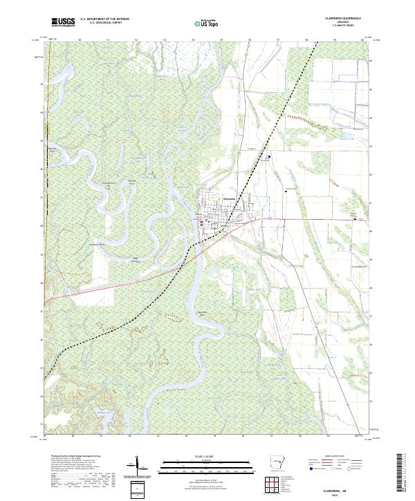
2024 Map of Clarendon
USGS Topo · Published 2024About this map
Clarendon stands as the primary riverfront settlement on this map, situated where several major bayous and forks meet the winding White River. The landscape is dominated by complex river hydraulics, characterized by numerous oxbows, sloughs, and point bars such as Franklin Point and the ominously named Dead Man Point. To the north and south, protected bottomlands within the Cache River National Wildlife Refuge and the Dale Bumpers White River National Wildlife Refuge preserve the native character of the Arkansas Delta. Local history is anchored by the Monroe County Courthouse in the town center, while rural life is traced through outlying landmarks like Shady Grove Cem and Mount Zion Cem. The intricate network of backwater lakes, including Big Weidmann Lake and Otter Lake, illustrates the shifting nature of the river's path over time, including the Crooked Point Cut-off.
Find a feature on this map
79 named features on this map. Tap any name to fly to it.
Don’t see what you’re looking for? This feature index may not catch every label — zoom into the map to look around manually.
Map Details
Editions of this 2024 Clarendon Map
This is the sole edition of this map. No revisions or reprints were ever made.
Other maps of this area

1935 · Clarendon
USGS Topo · 1:62,500

1940 · Holly Grove
USGS Topo · 1:62,500

1940 · Brinkley
USGS Topo · 1:62,500

1941 · De Valls Bluff
USGS Topo · 1:62,500

1941 · Clarendon
USGS Topo · 1:62,500

1948 · Helena
USGS Topo · 1:250,000

1950 · Helena
USGS Topo · 1:250,000

1955 · Helena
USGS Topo · 1:250,000
1957 · Clarendon
USGS Topo · 1:62,500

1957 · Holly Grove
USGS Topo · 1:62,500