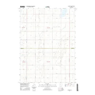
2015 Map of Clarion SW
USGS Topo · Published 2015About this map
Big Wall Lake dominates the northeastern corner of this rural Iowa landscape, situated just north of the border between Wright Co and Hamilton Co. The terrain is defined by a dense network of watercourses and agricultural drainage improvements, including the winding White Fox Cr and Lyons Cr. The presence of Ditch Number 3 and Ditch Number 144 illustrates the intensive land management required to sustain farming in this part of the state. Settlement follows a rigid section-line grid of gravel and paved roads, such as Co Rd R53 and Little Wall Lake Rd. In the southeastern quadrant, the headwaters of the S Fork Iowa River emerge, cutting through the geometric pattern of township roads like 190th St and Quincy Ave.
Find a feature on this map
39 named features on this map. Tap any name to fly to it.
Don’t see what you’re looking for? This feature index may not catch every label — zoom into the map to look around manually.
Map Details
Editions of this 2015 Clarion SW Map
This is the sole edition of this map. No revisions or reprints were ever made.
Other maps of this area

1954 · Waterloo
USGS Topo · 1:250,000

1955 · Waterloo
USGS Topo · 1:250,000

1978 · Blairsburg
USGS Topo · 1:24,000

1978 · Holmes
USGS Topo · 1:24,000

1978 · Woolstock
USGS Topo · 1:24,000

1978 · Clarion
USGS Topo · 1:24,000

1978 · Webster City
USGS Topo · 1:24,000

1978 · Sheldon Creek
USGS Topo · 1:24,000

1978 · Dows West
USGS Topo · 1:24,000

1978 · Clarion SW
USGS Topo · 1:24,000