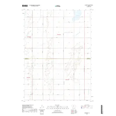
2018 Map of Clarion SW
USGS Topo · Published 2018About this map
Big Wall Lake dominates the northeastern corner of this prairie landscape, serving as a primary hydrological anchor in an area defined by extensive drainage management. The transition from Wright County to Hamilton County occurs mid-sheet, where the land is carved by a network of engineered waterways and natural streams. The presence of Ditch Number 144 and Ditch Number 3 alongside natural features like White Fox Creek and Lyons Creek reflects the intensive agricultural adaptation of the Iowa till plain. This grid of section-line roads, including County Highway R38 and Little Wall Lake Road, provides a structured view of the rural settlement pattern, while the headwaters of the South Fork Iowa River emerge in the southeast, illustrating the regional drainage towards the Iowa River basin.
Find a feature on this map
39 named features on this map. Tap any name to fly to it.
Don’t see what you’re looking for? This feature index may not catch every label — zoom into the map to look around manually.
Map Details
Editions of this 2018 Clarion SW Map
This is the sole edition of this map. No revisions or reprints were ever made.
Other maps of this area

1954 · Waterloo
USGS Topo · 1:250,000

1955 · Waterloo
USGS Topo · 1:250,000

1978 · Blairsburg
USGS Topo · 1:24,000

1978 · Holmes
USGS Topo · 1:24,000

1978 · Woolstock
USGS Topo · 1:24,000

1978 · Clarion
USGS Topo · 1:24,000

1978 · Webster City
USGS Topo · 1:24,000

1978 · Sheldon Creek
USGS Topo · 1:24,000

1978 · Dows West
USGS Topo · 1:24,000

1978 · Clarion SW
USGS Topo · 1:24,000