
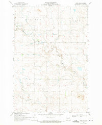
1960 Map of Clark Butte SW
USGS Topo · Published 1962About this map
Highland, Odessa, Steiner, and Walker townships define the cadastral landscape of this 1960 survey in Hettinger County. The map captures a quintessential North Dakota prairie settlement pattern, where social life revolved around a grid of rural institutions spaced for a horse-and-buggy era that was rapidly modernizing. Small centers of community identity are preserved here, including the New Burke Ch and the Friedenfeld Cem, which likely served the surrounding farmsteads. The transition from early 20th-century education is evident in the numbering of local schoolhouses, such as School No 5, School No 3, and School No 1, which provided focal points for the dispersed population. This map, produced as part of the Department of the Interior program for the development of the Missouri River Basin, provides a precise look at the land use and topography of the high plains before further rural consolidation.
Find a feature on this map
10 named features on this map. Tap any name to fly to it.
Don’t see what you’re looking for? This feature index may not catch every label — zoom into the map to look around manually.
Map Details
Editions of this 1960 Clark Butte SW Map
This is the sole edition of this map. No revisions or reprints were ever made.
Other maps of this area

1953 · Dickinson
USGS Topo · 1:250,000

1957 · Dickinson
USGS Topo · 1:250,000

1960 · Clark Butte NW
USGS Topo · 1:24,000

1960 · Clark Butte NE
USGS Topo · 1:24,000

1960 · White Butte NE
USGS Topo · 1:24,000

1960 · White Butte East
USGS Topo · 1:24,000

1960 · Clark Butte
USGS Topo · 1:24,000

1966 · Mott North
USGS Topo · 1:24,000

1969 · North Star Butte
USGS Topo · 1:24,000
1969 · Burt NW
USGS Topo · 1:24,000