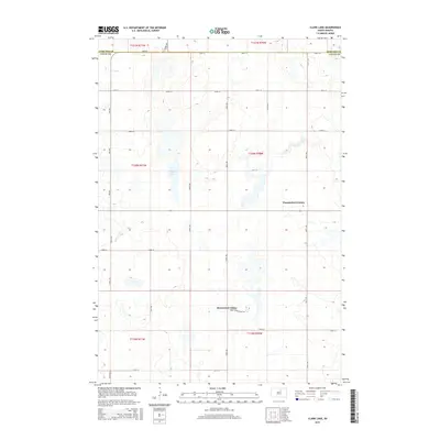
2015 Map of Clark Lake
USGS Topo · Published 2015About this map
Thunderbird Colony and Brentwood Colony anchor this agricultural landscape on the border of Edmunds and Faulk counties. The area is defined by a strictly surveyed grid of section roads including 340th Ave and 346th Ave, crossing east-west routes like 148th St. At the center of the sheet lies Clark Lake, a prominent water body surrounded by a complex network of smaller ephemeral basins and wetlands characteristic of the Prairie Pothole Region. This 2015 survey illustrates the distinctive communal settlement patterns of the Hutterite colonies, with clusters of residential and agricultural structures situated amidst vast open fields. Local transit is facilitated by dedicated routes such as Brentwood Colony Rd, providing a detailed view of the infrastructure supporting these specialized rural communities.
Find a feature on this map
24 named features on this map. Tap any name to fly to it.
Don’t see what you’re looking for? This feature index may not catch every label — zoom into the map to look around manually.
Map Details
Editions of this 2015 Clark Lake Map
This is the sole edition of this map. No revisions or reprints were ever made.
Other maps of this area

1950 · Onaka
USGS Topo · 1:24,000

1951 · Clark Lake
USGS Topo · 1:24,000

1952 · Onaka
USGS Topo · 1:24,000

1952 · Norbeck
USGS Topo · 1:24,000

1952 · Burkmere
USGS Topo · 1:24,000

1952 · Onaka SW
USGS Topo · 1:24,000

1952 · Faulkton West
USGS Topo · 1:24,000

1954 · Aberdeen
USGS Topo · 1:250,000

1956 · Aberdeen
USGS Topo · 1:250,000

1965 · Onaka
USGS Topo · 1:24,000
Featured Places
- Thunderbird Hutterite Colony, SD
- Brentwood Hutterite Colony, SD
- Edmunds County, SD
- Faulk County, SD
- United States