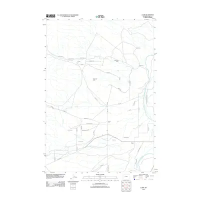
2012 Map of Clark
USGS Topo · Published 2012About this map
Clarks Fork Yellowstone River defines the eastern boundary of this landscape, supporting a complex network of irrigation infrastructure including the State Ditch, Sabine Ditch, and Kelly Ditch. The presence of Miles Battlefield and the Clark Cem south of the central settlement of Clark provides historical depth to this high-desert ranching territory. The terrain is punctuated by significant landmarks like Sugarloaf Butte and is deeply marked by a legacy of individual landholding, evidenced by the distribution of the Noble Ranch, Johnson Ranch, Owens Ranch, and Garrett Ranch. A modern road network, featuring evocatively named routes like Shining Mountain Rd and Crossfire Trl, overlays an older system of draws and creeks, including Robertson Draw and Littlerock Cr, that once dictated the movement of livestock and water across this Park County expanse.
Find a feature on this map
53 named features on this map. Tap any name to fly to it.
Don’t see what you’re looking for? This feature index may not catch every label — zoom into the map to look around manually.
Map Details
Editions of this 2012 Clark Map
This is the sole edition of this map. No revisions or reprints were ever made.
Other maps of this area

1944 · Red Lodge
USGS Topo · 1:62,500

1950 · Clark
USGS Topo · 1:62,500

1950 · Deep Lake
USGS Topo · 1:62,500

1954 · Billings
USGS Topo · 1:250,000

1955 · Cody
USGS Topo · 1:250,000

1956 · Mount Maurice
USGS Topo · 1:62,500

1957 · Billings
USGS Topo · 1:250,000

1958 · Billings
USGS Topo · 1:250,000

1958 · Cody
USGS Topo · 1:250,000

1962 · Cody
USGS Topo · 1:250,000