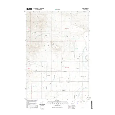
2015 Map of Clark
USGS Topo · Published 2015About this map
The Clarks Fork Yellowstone River defines the eastern edge of this Wyoming landscape, where high-desert terrain meets a sophisticated network of irrigation. The community of Clark serves as the focal point for a region crisscrossed by vital water works, including the Simpson Ditch, Shrine Ditch, and Kelly Ditch, which redirect water from the river and mountain drainages to support life in the rain shadow of the Absaroka Range. The topography is anchored by landmarks such as Sugarloaf Butte and the deep incision of Robertson Draw in the north.
Find a feature on this map
56 named features on this map. Tap any name to fly to it.
Don’t see what you’re looking for? This feature index may not catch every label — zoom into the map to look around manually.
Map Details
Editions of this 2015 Clark Map
This is the sole edition of this map. No revisions or reprints were ever made.
Other maps of this area

1944 · Red Lodge
USGS Topo · 1:62,500

1950 · Clark
USGS Topo · 1:62,500

1950 · Deep Lake
USGS Topo · 1:62,500

1954 · Billings
USGS Topo · 1:250,000

1955 · Cody
USGS Topo · 1:250,000

1956 · Mount Maurice
USGS Topo · 1:62,500

1957 · Billings
USGS Topo · 1:250,000

1958 · Billings
USGS Topo · 1:250,000

1958 · Cody
USGS Topo · 1:250,000

1962 · Cody
USGS Topo · 1:250,000