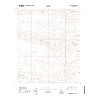
2023 Map of Clark Spring Canyon
USGS Topo · Published 2023About this map
Clark Spring and Shorthorn Springs mark critical water points in this arid stretch of Sierra County, where the landscape is defined by a network of ephemeral drainage systems. The map detail highlights the complex hydrography of the region, from the northern Trujillo Canyon to the southern Berrenda Creek. Ranching and land management infrastructure is evident through scattered water improvements like Cedar Tank and Teacup Tank, which provide vital resources in a terrain bisected by the deep cuts of Sibley Canyon and the namesake Clark Spring Canyon. Aside from the presence of Heritage Rd in the southwest corner, the area remains largely defined by its natural topography and seasonal waterways, including Tierra Blanca Creek and Montoya Arroyo, which trace the path of runoff through the high desert.
Find a feature on this map
18 named features on this map. Tap any name to fly to it.
Don’t see what you’re looking for? This feature index may not catch every label — zoom into the map to look around manually.
Map Details
Editions of this 2023 Clark Spring Canyon Map
This is the sole edition of this map. No revisions or reprints were ever made.
Other maps of this area

1935 · Hillsboro
USGS Topo · 1:48,000

1940 · Hillsboro
USGS Topo · 1:62,500

1955 · Las Cruces
USGS Topo · 1:250,000

1958 · Las Cruces
USGS Topo · 1:250,000

1958 · Arroyo Cuervo
USGS Topo · 1:24,000

1961 · Skute Stone Arroyo
USGS Topo · 1:24,000

1961 · Caballo
USGS Topo · 1:24,000

1961 · Nutt
USGS Topo · 1:62,500

1961 · Clark Spring Canyon
USGS Topo · 1:24,000

1961 · Garfield
USGS Topo · 1:24,000