
1958 Map of Arroyo Cuervo
USGS Topo · Published 1960About this map
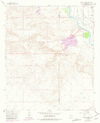
The Rincon Valley landscape in the late 1950s is defined by the contrast between the fertile agricultural corridor of the Rio Grande and the arid, dissected uplands to the west. Irrigation infrastructure is critical here, with the Garfield Canal and Garfield Lateral drawing water from the river to support the narrow valley floor. The map captures a transition in transportation and infrastructure, noting the Hatch Airport (Abandoned) and a small Claypit reflecting local industry. Cultural landmarks such as La Capilla de Don Silverio and various Ruins indicate a deep-rooted but sparse settlement pattern. Drainage systems like Arroyo Cuervo and Arroyo de Montoya cut through the western mesas, creating the characteristic topography of the Sierra and Doña Ana county line.
Find a feature on this map
20 named features on this map. Tap any name to fly to it.
Don’t see what you’re looking for? This feature index may not catch every label — zoom into the map to look around manually.
Map Details
Editions of this 1958 Arroyo Cuervo Map
2 editions found
Other maps of this area

1955 · Las Cruces
USGS Topo · 1:250,000

1958 · Las Cruces
USGS Topo · 1:250,000

1959 · Hatch
USGS Topo · 1:24,000
1959 · Souse Springs
USGS Topo · 1:24,000

1959 · Upham
USGS Topo · 1:62,500

1961 · Nutt
USGS Topo · 1:62,500

1961 · Clark Spring Canyon
USGS Topo · 1:24,000

1961 · Garfield
USGS Topo · 1:24,000

1982 · Hatch
USGS Topo · 1:100,000
1985 · McLeod Tank
USGS Topo · 1:24,000