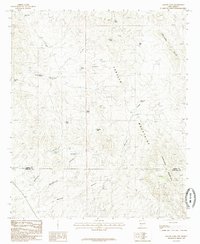
1985 Map of McLeod Tank
USGS Topo · Published 1985About this map
The Caballo Mountains dominate this arid landscape along the border of Sierra and Dona Ana counties, revealing a complex network of desert drainages and watering points in the mid-1980s. The topography is defined by prominent elevations such as Redhouse Mountain and the McLeod Hills, which are dissected by deep erosional features including Green Canyon and McLeod Canyon. The map records a critical infrastructure of named water tanks essential for ranching and survival in this environment, from the Broken House Tank in the west to the Mine Tank in the north. This distribution of water sources, including the Escondido Tank and Red Hill Tank, illustrates how the land was managed and utilized in the years following the mid-century. Seasonal water movement is traced through McLeod Draw and various unnamed arroyos that feed into the larger basins.
Find a feature on this map
24 named features on this map. Tap any name to fly to it.
Don’t see what you’re looking for? This feature index may not catch every label — zoom into the map to look around manually.
Map Details
Editions of this 1985 McLeod Tank Map
This is the sole edition of this map. No revisions or reprints were ever made.
Other maps of this area

1955 · Las Cruces
USGS Topo · 1:250,000

1958 · Las Cruces
USGS Topo · 1:250,000

1958 · Arroyo Cuervo
USGS Topo · 1:24,000

1959 · Hatch
USGS Topo · 1:24,000

1959 · Rincon
USGS Topo · 1:24,000

1959 · Upham
USGS Topo · 1:62,500

1961 · Caballo
USGS Topo · 1:24,000

1961 · Nutt
USGS Topo · 1:62,500

1961 · Garfield
USGS Topo · 1:24,000

1982 · Hatch
USGS Topo · 1:100,000