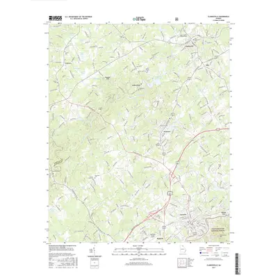
2017 Map of Clarkesville
USGS Topo · Published 2017About this map
The Soquee River winds through this Habersham County landscape, serving as a focal point for several established communities including Clarkesville, Demorest, and Cornelia. The settlement pattern reflects a mix of traditional river-valley town sites and higher-elevation development, with Chenocetah Mtn rising to the southeast and the Chattahoochee National Forest providing a natural boundary. A strong institutional presence is evident at Piedmont College in Demorest, while the Southern railroad line establishes the industrial corridor through Cornelia and Baldwin.
Find a feature on this map
248 named features on this map. Tap any name to fly to it.
Don’t see what you’re looking for? This feature index may not catch every label — zoom into the map to look around manually.
Map Details
Editions of this 2017 Clarkesville Map
This is the sole edition of this map. No revisions or reprints were ever made.
Other maps of this area

1886 · Dahlonega
USGS Topo · 1:125,000

1886 · Walhalla
USGS Topo · 1:125,000

1891 · Gainesville
USGS Topo · 1:125,000

1891 · Carnesville
USGS Topo · 1:125,000

1892 · Dahlonega
USGS Topo · 1:125,000

1892 · Walhalla
USGS Topo · 1:125,000

1896 · Walhalla
USGS Topo · 1:125,000

1896 · Dahlonega
USGS Topo · 1:125,000

1903 · Dahlonega
USGS Topo · 1:125,000

1953 · Tallulah Falls
USGS Topo · 1:24,000