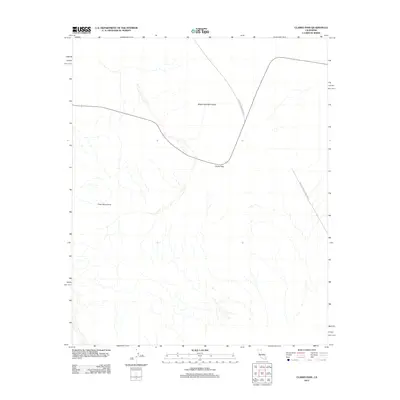
2012 Map of Clarks Pass
USGS Topo · Published 2012About this map
The Sheep Hole Mountains dominate the northern landscape of this Mojave Desert region, rising above the pass that connects these peaks with the Pinto Mountains to the south. This 2012 survey illustrates the remote desert terrain as it appeared before major modern infrastructure changes, centering on Clarks Pass where the primary thoroughfare, Sheep Hole Mountains Rd, traverses the high desert gap. The southeastern corner of the map captures the transition into Joshua Tree National Park, providing a record of the park's boundaries and the undeveloped wilderness at the start of the decade. The map reveals the intricate network of desert washes and elevation contours that define this arid environment.
Find a feature on this map
5 named features on this map. Tap any name to fly to it.
Don’t see what you’re looking for? This feature index may not catch every label — zoom into the map to look around manually.
Map Details
Editions of this 2012 Clarks Pass Map
This is the sole edition of this map. No revisions or reprints were ever made.
Other maps of this area

1942 · Amboy
USGS Topo · 1:250,000

1943 · Amboy
USGS Topo · 1:250,000

1943 · Cadiz Valley
USGS Topo · 1:62,500

1943 · Coxcomb Mountains
USGS Topo · 1:62,500

1944 · Eagle Tank
USGS Topo · 1:62,500

1944 · Coxcomb Mountains
USGS Topo · 1:62,500

1954 · Salton Sea
USGS Topo · 1:250,000

1954 · Needles
USGS Topo · 1:250,000

1955 · Salton Sea
USGS Topo · 1:250,000

1956 · Needles
USGS Topo · 1:250,000