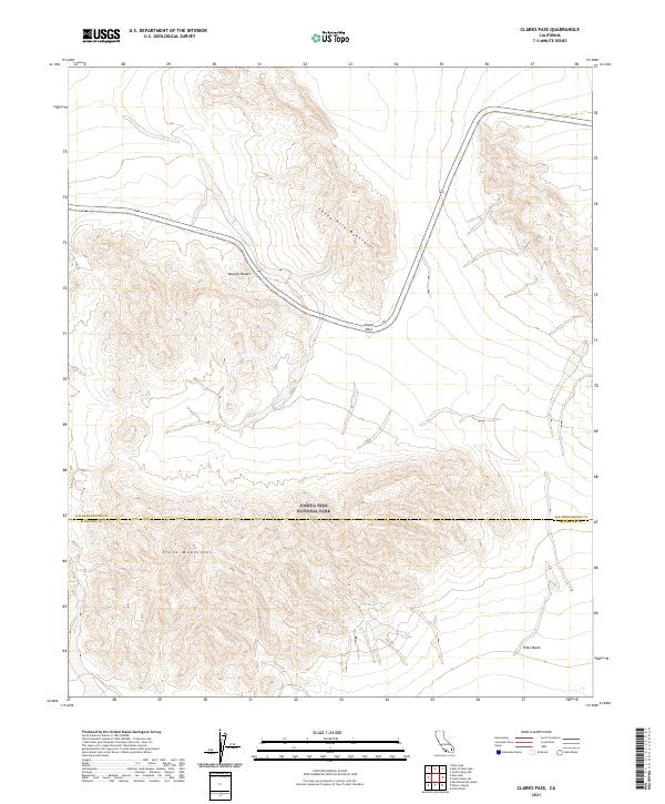
2021 Map of Clarks Pass
USGS Topo · Published 2021About this map
Joshua Tree National Park spans the southern half of this desert landscape, where the Pinto Mountains rise from the arid floor of the Pinto Basin. This 2021 survey by the U.S. Geological Survey captures the rugged transition between these highlands and the Sheep Hole Mountains to the north. A critical corridor through the terrain is defined by Clarks Pass, which provides passage through the high ground separating these two mountain ranges. The map also delineates the jurisdictional boundary where the San Bernardino County and Riverside County line intersects the northern reaches of the park. Situated within the broader Mojave Desert, the area is characterized by dramatic elevation changes and the stark, open topography typical of the high desert wilderness.
Find a feature on this map
13 named features on this map. Tap any name to fly to it.
Don’t see what you’re looking for? This feature index may not catch every label — zoom into the map to look around manually.
Map Details
Editions of this 2021 Clarks Pass Map
This is the sole edition of this map. No revisions or reprints were ever made.
Other maps of this area

1942 · Amboy
USGS Topo · 1:250,000

1943 · Amboy
USGS Topo · 1:250,000

1943 · Cadiz Valley
USGS Topo · 1:62,500

1943 · Coxcomb Mountains
USGS Topo · 1:62,500

1944 · Eagle Tank
USGS Topo · 1:62,500

1944 · Coxcomb Mountains
USGS Topo · 1:62,500

1954 · Salton Sea
USGS Topo · 1:250,000

1954 · Needles
USGS Topo · 1:250,000

1955 · Salton Sea
USGS Topo · 1:250,000

1956 · Needles
USGS Topo · 1:250,000