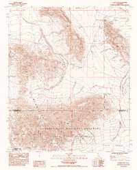
1985 Map of Clarks Pass
USGS Topo · Published 1985About this map
The arid high-desert border between San Bernardino and Riverside counties is defined here by the convergence of the Sheephole Mountains and the Pinto Mountains. Recorded in the mid-1980s, the terrain is characterized by steep ridges and sprawling desert washes, with Clarks Pass serving as a natural corridor between these mountain ranges. A significant portion of the landscape is dedicated to conservation, split between the Joshua Tree National Monument and the more restrictive Joshua Tree Wilderness to the south.
Find a feature on this map
12 named features on this map. Tap any name to fly to it.
Don’t see what you’re looking for? This feature index may not catch every label — zoom into the map to look around manually.
Map Details
Editions of this 1985 Clarks Pass Map
This is the sole edition of this map. No revisions or reprints were ever made.
Other maps of this area

1942 · Amboy
USGS Topo · 1:250,000

1943 · Amboy
USGS Topo · 1:250,000

1943 · Cadiz Valley
USGS Topo · 1:62,500

1943 · Coxcomb Mountains
USGS Topo · 1:62,500

1944 · Eagle Tank
USGS Topo · 1:62,500

1944 · Coxcomb Mountains
USGS Topo · 1:62,500

1954 · Salton Sea
USGS Topo · 1:250,000

1954 · Needles
USGS Topo · 1:250,000

1955 · Salton Sea
USGS Topo · 1:250,000

1956 · Needles
USGS Topo · 1:250,000