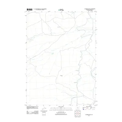
2012 Map of Clarkson Hill
USGS Topo · Published 2012About this map
Clarkson Hill rises over this Natrona County landscape, a terrain defined by sparse ranching developments and critical water infrastructure. In the early 21st century, the Clarkson Ranch remains a focal point of human settlement in a region shaped by high plains drainage and historical transit routes. The landscape is marked by the winding path of the N Platte River to the east and the intricate irrigation or utility network suggested by Canal Rd and Canal Bank Rd in the southern reaches. Industrial and engineering feats are evident through Tunnel Number 3 and Tunnel Number 4, which cut through the local topography. This area also maintains a connection to western migration history with the presence of Oregon Trail Rd, while seasonal drainages like Willow Cr and Iron Cr carve out the local hydrology.
Find a feature on this map
12 named features on this map. Tap any name to fly to it.
Don’t see what you’re looking for? This feature index may not catch every label — zoom into the map to look around manually.
Map Details
Editions of this 2012 Clarkson Hill Map
This is the sole edition of this map. No revisions or reprints were ever made.
Other maps of this area

1950 · Emigrant Gap
USGS Topo · 1:24,000

1950 · Alcova SE
USGS Topo · 1:24,000

1950 · Alcova
USGS Topo · 1:24,000

1951 · Oil Mountain
USGS Topo · 1:24,000

1951 · Clarkson Hill
USGS Topo · 1:24,000

1951 · Benton Basin
USGS Topo · 1:24,000

1951 · Poison Spider
USGS Topo · 1:24,000

1951 · Bessemer Mountain
USGS Topo · 1:24,000

1951 · Benton Basin NE
USGS Topo · 1:24,000

1955 · Casper
USGS Topo · 1:250,000