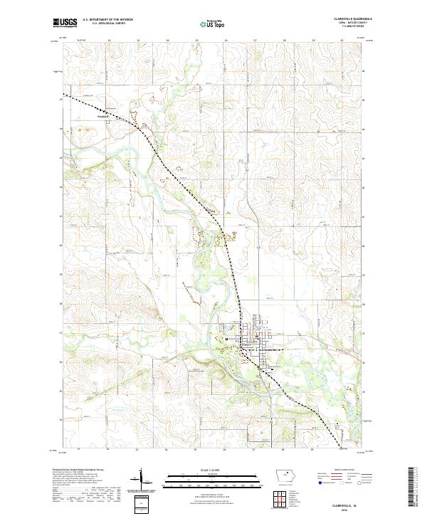
2022 Map of Clarksville
USGS Topo · Published 2022About this map
Clarksville serves as the central hub of this Butler County landscape, situated along the winding course of the Shell Rock River. The town's grid is detailed with street names like W Jefferson St and S Main St, while historical sites such as Lynwood Cem and Old Town Cem provide anchor points for local researchers. To the northwest, the smaller settlement of Packard sits near the banks of Flood Cr, connected to the surrounding countryside by a network of rural routes including Range Rd and Sandhill Rd. The terrain is defined by the drainage patterns of Beaver Cr and Moulfon Cr, alongside the recreational path of the Rolling Prairie Trl. This survey illustrates a typical midwestern agricultural and riverine community, showing the persistence of early burial grounds like Lowell Cem amidst modern county road improvements.
Find a feature on this map
61 named features on this map. Tap any name to fly to it.
Don’t see what you’re looking for? This feature index may not catch every label — zoom into the map to look around manually.
Map Details
Editions of this 2022 Clarksville Map
This is the sole edition of this map. No revisions or reprints were ever made.
Other maps of this area

1954 · Waterloo
USGS Topo · 1:250,000

1955 · Waterloo
USGS Topo · 1:250,000

1971 · Shell Rock
USGS Topo · 1:24,000

1971 · Coster
USGS Topo · 1:24,000

1971 · Plainfield
USGS Topo · 1:24,000

1971 · Nashua NW
USGS Topo · 1:24,000

1971 · Clarksville
USGS Topo · 1:24,000
1971 · Nashua
USGS Topo · 1:24,000

1972 · Allison
USGS Topo · 1:24,000
1972 · Greene
USGS Topo · 1:24,000