
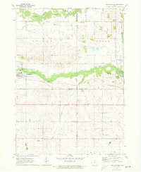
1971 Map of Shell Rock
USGS Topo · Published 1973About this map
Shell Rock River meanders through the heart of this landscape, defining the industrial and recreational character of Butler and Bremer counties in the early 1970s. The town of Shell Rock serves as a primary hub, situated where the Chicago Rock Island and Pacific railroad crosses the water. To the south, the village of Finchford sits near the confluence with the West Fork Cedar River, an area marked by the Thunder Woman County Park and a complex network of wetlands.
Find a feature on this map
35 named features on this map. Tap any name to fly to it.
Don’t see what you’re looking for? This feature index may not catch every label — zoom into the map to look around manually.
Map Details
Editions of this 1971 Shell Rock Map
This is the sole edition of this map. No revisions or reprints were ever made.
Other maps of this area

1954 · Waterloo
USGS Topo · 1:250,000

1955 · Waterloo
USGS Topo · 1:250,000

1963 · Waverly
USGS Topo · 1:24,000

1963 · Cedar Falls
USGS Topo · 1:24,000

1971 · Bremer
USGS Topo · 1:24,000

1971 · Coster
USGS Topo · 1:24,000

1971 · Plainfield
USGS Topo · 1:24,000

1971 · Clarksville
USGS Topo · 1:24,000

1971 · Stout
USGS Topo · 1:24,000
1971 · New Hartford
USGS Topo · 1:24,000