
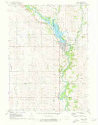
1971 Map of Plainfield
USGS Topo · Published 1973About this map
The town of Plainfield sits at the intersection of the Illinois Central railroad and the Cedar River, serving as a central hub in this 1971 topographical study. The landscape is defined by the parallel paths of the Cedar and the Shell Rock River, with the Chicago and North Western line cutting across the southwestern corner of Butler and Bremer counties. This era reveals a well-developed rural infrastructure, with small community anchors such as Pleasant Valley Ch and Antioch Ch providing local landmarks for genealogists. The map also traces the winding drainage of Beaver Creek and Horton Dry Cr Run, which feed into the primary river systems. In the southeast, Cedar Bend County Park and Spring Lake Cem mark the river's edge, highlighting the mix of recreational and historical sites along the water.
Find a feature on this map
21 named features on this map. Tap any name to fly to it.
Don’t see what you’re looking for? This feature index may not catch every label — zoom into the map to look around manually.
Map Details
Editions of this 1971 Plainfield Map
This is the sole edition of this map. No revisions or reprints were ever made.
Other maps of this area

1954 · Waterloo
USGS Topo · 1:250,000

1955 · Waterloo
USGS Topo · 1:250,000

1963 · Waverly
USGS Topo · 1:24,000

1971 · Shell Rock
USGS Topo · 1:24,000

1971 · Bremer
USGS Topo · 1:24,000

1971 · Tripoli NW
USGS Topo · 1:24,000

1971 · Coster
USGS Topo · 1:24,000

1971 · Nashua NW
USGS Topo · 1:24,000

1971 · Clarksville
USGS Topo · 1:24,000
1971 · Nashua
USGS Topo · 1:24,000