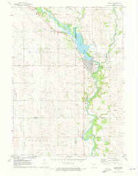
1971 Map of Nashua
USGS Topo · Published 1973About this map
Nashua sits at the confluence of the Cedar River and the Little Cedar River, a landscape defined by the impoundment of Cedar Lake and a series of private aviation facilities. This early 1970s survey documents the town’s infrastructure, from the Illinois Central railroad corridor to the local Fairground and Golf Course. Notable for family historians, the area is dotted with several well-established burial grounds, including Saint Michaels Cem, Oak Hill Cem, and Jackson Cem.
Find a feature on this map
37 named features on this map. Tap any name to fly to it.
Don’t see what you’re looking for? This feature index may not catch every label — zoom into the map to look around manually.
Map Details
Editions of this 1971 Nashua Map
This is the sole edition of this map. No revisions or reprints were ever made.
Other maps of this area

1954 · Mason City
USGS Topo · 1:250,000

1954 · Waterloo
USGS Topo · 1:250,000

1955 · Waterloo
USGS Topo · 1:250,000

1957 · Mason City
USGS Topo · 1:250,000

1958 · Mason City
USGS Topo · 1:250,000

1971 · Bremer
USGS Topo · 1:24,000

1971 · Tripoli NW
USGS Topo · 1:24,000

1971 · Plainfield
USGS Topo · 1:24,000

1971 · Charles City
USGS Topo · 1:24,000

1971 · Nashua NW
USGS Topo · 1:24,000