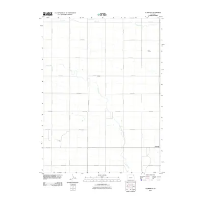
2010 Map of Clarkville
USGS Topo · Published 2010About this map
Clarkville anchors the southeastern corner of this high plains landscape in Yuma County, Colorado. The settlement is defined by a grid of rural county roads that facilitate access to the surrounding agricultural land, with County Rd-56 and County Rd L marking the immediate vicinity. Two significant local burial sites, Bryant Cemetery in the northeast and Rockland Cemetery near the center, serve as important landmarks for family historians and genealogists researching the residents of this prairie region. The hydrology is dominated by the winding paths of Coyote Creek and Patent Creek, which cut through the level terrain. In the southwest, the landform known as Antelope Gap suggests a natural passage or break in the topography, reflecting the region's character as a classic western grassland managed through an extensive network of range roads and section lines.
Find a feature on this map
29 named features on this map. Tap any name to fly to it.
Don’t see what you’re looking for? This feature index may not catch every label — zoom into the map to look around manually.
Map Details
Editions of this 2010 Clarkville Map
This is the sole edition of this map. No revisions or reprints were ever made.
Other maps of this area

1954 · Sterling
USGS Topo · 1:250,000

1958 · Sterling
USGS Topo · 1:250,000

1971 · Clarkville NE
USGS Topo · 1:24,000

1971 · Haxtun SE
USGS Topo · 1:24,000

1971 · Clarkville SE
USGS Topo · 1:24,000

1972 · Clarkville
USGS Topo · 1:24,000

1972 · New Haven
USGS Topo · 1:24,000

1972 · St Petersburg
USGS Topo · 1:24,000

1972 · Rockland
USGS Topo · 1:24,000

1972 · Lone Star
USGS Topo · 1:24,000