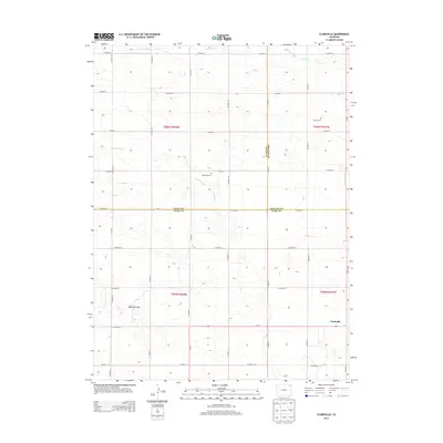
2013 Map of Clarkville
USGS Topo · Published 2013About this map
Clarkville stands in the southeast corner of this High Plains landscape where the borders of Logan, Yuma, and Phillips counties meet. The area is defined by a rigorous grid of section lines and county roads, reflecting the systematic land division of the American West. Key landmarks for local history and genealogy include the Rockland Cem and Bryant Cem, which serve as quiet markers of the early farming families who settled this corner of Colorado. The terrain is subtly interrupted by the drainage of Coyote Creek and Patent Creek, which meander across the township lines. To the west, the topography shifts slightly at Antelope Gap, a natural passage through the low-lying hills. This 2013 survey illustrates the enduring agricultural character of the region, where the intersection of three counties created a unique geographic pocket centered around the namesake settlement.
Find a feature on this map
38 named features on this map. Tap any name to fly to it.
Don’t see what you’re looking for? This feature index may not catch every label — zoom into the map to look around manually.
Map Details
Editions of this 2013 Clarkville Map
This is the sole edition of this map. No revisions or reprints were ever made.
Other maps of this area

1954 · Sterling
USGS Topo · 1:250,000

1958 · Sterling
USGS Topo · 1:250,000

1971 · Clarkville NE
USGS Topo · 1:24,000

1971 · Haxtun SE
USGS Topo · 1:24,000

1971 · Clarkville SE
USGS Topo · 1:24,000

1972 · Clarkville
USGS Topo · 1:24,000

1972 · New Haven
USGS Topo · 1:24,000

1972 · St Petersburg
USGS Topo · 1:24,000

1972 · Rockland
USGS Topo · 1:24,000

1972 · Lone Star
USGS Topo · 1:24,000